


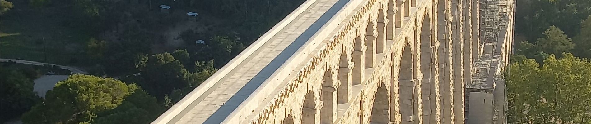
Ventabren Roquefavour

counoise
User
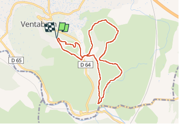

Length
9.4 km

Max alt
246 m

Uphill gradient
168 m
Km-Effort
11.6 km

Min alt
162 m

Downhill gradient
167 m
Boucle
Yes
Creation date :
2022-10-16 13:34:21.383
Updated on :
2022-10-16 16:52:43.402
1h50
Difficulty : Very easy

FREE GPS app for hiking
 SityTrail
IGN / Geographical institutes
SityTrail Plus
The world is yours!
About
Trail Walking of 9.4 km to be discovered at Provence-Alpes-Côte d'Azur, Bouches-du-Rhône, Ventabren. This trail is proposed by counoise.
Photos

Positioning
Country:
France
Region :
Provence-Alpes-Côte d'Azur
Department/Province :
Bouches-du-Rhône
Municipality :
Ventabren
Location:
Unknown
Start:(Dec)
Start:(UTM)
685750 ; 4822781 (31T) N.
Comments