Trail Walking Virton - Sentier des Dragons  -  Marche_4kms - Photo

Sentier des Dragons - Marche_4kms

 Pascal L
Pascal L

User

© OpenStreetMap contributors
Length
Length
3.5 km
Max alt
Max alt
265 m
Uphill gradient
Uphill gradient
68 m
Km-Effort
Km-Effort  
4.4 km
Min alt
Min alt
213 m
Downhill gradient
Downhill gradient
72 m
Boucle
Boucle
Yes
Creation date :
2022-09-21 15:21:50.402
Updated on :
2023-07-13 13:17:26.096

(0 Reviews)

Walking
Walking
47m
Difficulty : Easy

Scan this QR Code to open this trail in the SityTrail application

FREE GPS app for hiking

Logo SityTrail SityTrail

IGN / Geographical institutes

Download SityTrail from the App Store Download SityTrail from Google Play

Logo SityTrail SityTrail World

The world is yours!

Download SityTrail from the App Store Download SityTrail from Google Play Download SityTrail on Huawei AppGallery

About

Trail Walking of 3.5 km to be discovered at Wallonia, Luxembourg, Virton. This trail is proposed by Pascal L.

Description

Petite marche le long du Bois de Bampont, avec de beaux points de vues sur la Réserve Naturelle des Marais du Ton.

Départ/Retour: Pierrard
Endroits de passage : Rue de Pierrard, Bois de Bampont, hors piste (sentier des dragons "revisité"), Ravel (ligne 155), Ruisseau le Ton, Réseve Naturelle des Marais du Ton, Pierrard (Institut des Arts et Métiers).

Vidéo: https://vimeo.com/760851591

Ref.
- http://biodiversite.wallonie.be/fr/6925-marais-du-ton.html?IDD=335545245&IDC=2831
- https://www.topsante.com/medecine/votre-sante-vous/sante-pratique/bienfaits-marche-sur-la-sante-637787

Rappel: la marche a de nombreux effets bénéfiques sur nos organismes. Il est recommandé de pratiquer au moins 30 minutes d’activité physique par jour. Nous sommes programmés pour marcher !

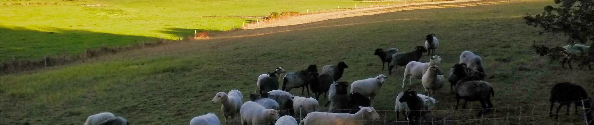
Remarque: cette marche comporte quelques obstacles (franchissement d’une clôture de barbelés, animaux, ...)

(2022.09.21)

Elevation profile

Photos

39 photos in total. Please click on a photo to see them all in the gallery.

Positioning

Country:
Belgium
Region :
Wallonia
Department/Province :
Luxembourg
Municipality :
Virton
Location:
Unknown
Start:(UTM)
684421 ; 5493806 (31U) N.

Trails nearby

Trail Walking Virton - RB-Lu-17_Ethe_via-var-1-et-2-et-3 - Photo
Walking
PRO

Walking

Very easy
(3)
Virton, Wallonia, Luxembourg, Belgium
29 km | 35 km-effort
7h 33min
Yes
Trail Mountain bike Virton - T2019-06-16-16-47 - Photo
Mountain bike
Pascal L

Mountain bike

Easy
(1)
Virton, Wallonia, Luxembourg, Belgium
21 km | 26 km-effort
1h 40min
Yes
Trail Walking Virton - GAUME Balade  naturelle et historique - Photo
Walking
julucasi

Walking

Very easy
(1)
Virton, Wallonia, Luxembourg, Belgium
5.2 km | 6.8 km-effort
1h 16min
Yes
Trail On foot Virton - La Bajocienne - Photo
On foot
GUIDE+

On foot

Easy
(1)
Virton, Wallonia, Luxembourg, Belgium
11 km | 14.5 km-effort
3h 17min
Yes
Trail On foot Virton - 12479951-Entre village et fruits - Photo
On foot
GUIDE
DUPONT Rita

On foot

Easy
Virton, Wallonia, Luxembourg, Belgium
6.4 km | 7.7 km-effort
1h 45min
Yes
Trail Walking Virton - RB-Lu-17_Ethe_via-racc - Photo
Walking
PRO

Walking

Very easy
Virton, Wallonia, Luxembourg, Belgium
15.6 km | 19.3 km-effort
4h 8min
Yes
Trail Walking Virton - RB-Lu-17_Ethe - Photo
Walking
PRO

Walking

Very easy
Virton, Wallonia, Luxembourg, Belgium
22 km | 28 km-effort
5h 55min
Yes
Trail Mountain bike Virton - Autour de Tintigny  -  Balade_VTT_54Kms - Photo
Mountain bike
Pascal L

Mountain bike

Very difficult
Virton, Wallonia, Luxembourg, Belgium
54 km | 64 km-effort
4h 25min
Yes
Trail Mountain bike Virton - Monquintin  -  Balade_VTT_22Kms - Photo
Mountain bike
Pascal L

Mountain bike

Medium
Virton, Wallonia, Luxembourg, Belgium
22 km | 26 km-effort
1h 48min
Yes


Close
My subscriptions