


col del'aigleton

MICDURAND
User
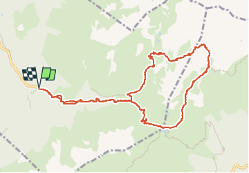

Length
11.8 km

Max alt
2274 m

Uphill gradient
998 m
Km-Effort
25 km

Min alt
1351 m

Downhill gradient
994 m
Boucle
Yes
Creation date :
2022-10-22 07:42:48.941
Updated on :
2022-10-23 15:27:52.22
3h10
Difficulty : Medium

FREE GPS app for hiking
 SityTrail
IGN / Geographical institutes
SityTrail Plus
The world is yours!
About
Trail Walking of 11.8 km to be discovered at Auvergne-Rhône-Alpes, Isère, Laval-en-Belledonne. This trail is proposed by MICDURAND.
Positioning
Country:
France
Region :
Auvergne-Rhône-Alpes
Department/Province :
Isère
Municipality :
Laval-en-Belledonne
Location:
Unknown
Start:(Dec)
Start:(UTM)
735418 ; 5012258 (31T) N.
Comments