Trail Walking Montlebon - montlebon - Photo
© OpenStreetMap contributors
Length
Length
16.4 km
Max alt
Max alt
1285 m
Uphill gradient
Uphill gradient
488 m
Km-Effort
Km-Effort  
23 km
Min alt
Min alt
916 m
Downhill gradient
Downhill gradient
491 m
Boucle
Boucle
Yes
Creation date :
2022-10-17 07:51:48.807
Updated on :
2022-10-25 10:25:16.55

(0 Reviews)

Walking
Walking
6h01
Difficulty : Medium

Scan this QR Code to open this trail in the SityTrail application

FREE GPS app for hiking

Logo SityTrail SityTrail

IGN / Geographical institutes

Download SityTrail from the App Store Download SityTrail from Google Play

Logo SityTrail SityTrail World

The world is yours!

Download SityTrail from the App Store Download SityTrail from Google Play Download SityTrail on Huawei AppGallery

About

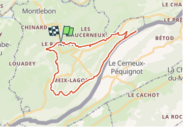
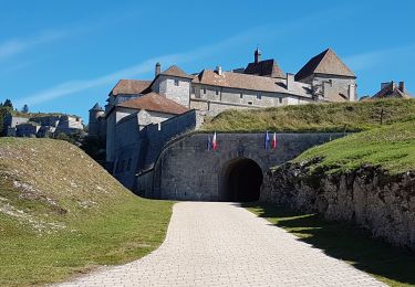
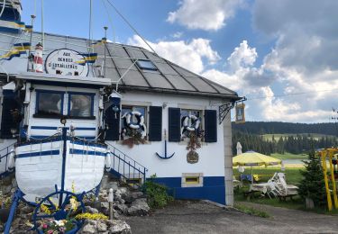
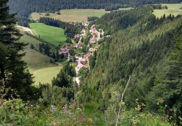
Trail Walking of 16.4 km to be discovered at Bourgogne-Franche-Comté, Doubs, Montlebon. This trail is proposed by eltonnermou.

Description

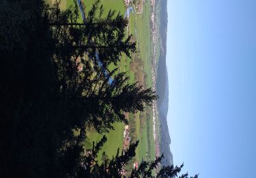
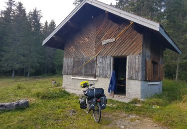
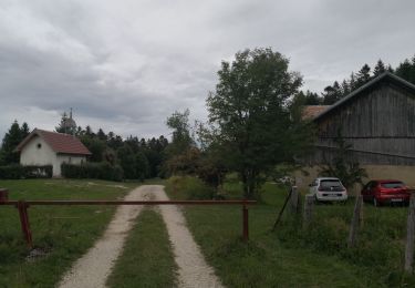
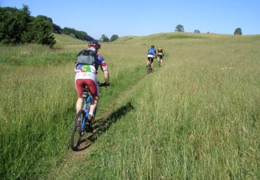
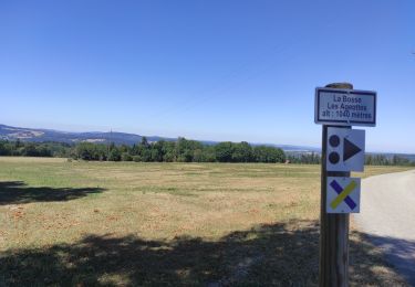
Très, très belle randonnée essentiellement en de magnifiques sous bois, avec des beaux points de vue sur le val de Morteau, des Gras ; sur les monts de la Suisse et du haut-doubs ; des passages en montée un peu plus engageants (bâtons fortement conseillés). Vous longerez la frontière suisse, et y mettrez parfois les pieds (en Suisse), avant de rejoindre le Gardot (village) où vous pourrez profiter de tables et bancs pour une pause. Prenez le temps dans la descente du retour d'admirer les "statues" réalisées par un personnage "haut en imagination".
Et comme dans de tels paysages, laissez vous surprendre par la faune et la flore.

Elevation profile

Photos

47 photos in total. Please click on a photo to see them all in the gallery.

Positioning

Country:
France
Region :
Bourgogne-Franche-Comté
Department/Province :
Doubs
Municipality :
Montlebon
Location:
Unknown
Start:(UTM)
319248 ; 5211022 (32T) N.

Trails nearby

Trail Walking Grand'Combe-Châteleu - Grand Combe Chateleu  - Photo
Walking
eltonnermou

Walking

Very difficult
Grand'Combe-Châteleu, Bourgogne-Franche-Comté, Doubs, France
17.2 km | 27 km-effort
6h 5min
Yes
Trail Walking Morteau - Via Cluny: de Morteau (Montagnes du Jura) à Cluny (Bourgogne) - Photo
Walking
GUIDE
ViaCluny

Walking

Very difficult
Morteau, Bourgogne-Franche-Comté, Doubs, France
445 km | 590 km-effort
134h 8min
No
Trail Bicycle tourism Les Fins - GTJ #2  - Photo
Bicycle tourism
GUIDE
David25400

Bicycle tourism

Difficult
Les Fins, Bourgogne-Franche-Comté, Doubs, France
103 km | 125 km-effort
9h 35min
No
Trail Road bike Villers-le-Lac - VILLERS LE LAC - MORTEAU - PONTARLIER - JOUX - LE LOCLE - VILLERS LE LAC - Photo
Road bike
jean-marie.parachini

Road bike

Medium
Villers-le-Lac, Bourgogne-Franche-Comté, Doubs, France
88 km | 108 km-effort
5h 26min
Yes
Trail Walking  - Montlebon Suisse La Brévine - Photo
Walking
i20

Walking

Medium
, Bourgogne-Franche-Comté, Doubs, France
15.2 km | 22 km-effort
3h 19min
Yes
Trail Mountain bike Morteau - Grandes Traversées du Jura - Haut Doubs - Photo
Mountain bike
tracegps

Mountain bike

Very difficult
Morteau, Bourgogne-Franche-Comté, Doubs, France
89 km | 117 km-effort
8h 0min
No
Trail Hybrid bike Morteau - Morteau - Roche au prêtre AR - Photo
Hybrid bike
danaubrac

Hybrid bike

Medium
Morteau, Bourgogne-Franche-Comté, Doubs, France
45 km | 56 km-effort
3h 20min
Yes
Trail Road bike Morteau - Sortie jura - Photo
Road bike
tophebal

Road bike

Morteau, Bourgogne-Franche-Comté, Doubs, France
85 km | 103 km-effort
4h 24min
Yes
Trail Walking Villers-le-Lac - Étape 7 : Villers-le-Lac à Vieux Chateleu - Photo
Walking
annefrance70

Walking

Medium
Villers-le-Lac, Bourgogne-Franche-Comté, Doubs, France
18.6 km | 28 km-effort
6h 23min
No


Close
My subscriptions