Trail Moto cross Almuñécar - Balade par Alhama de Granada et Zafarraya - Photo

Balade par Alhama de Granada et Zafarraya

© OpenStreetMap contributors
Length
Length
184 km
Max alt
Max alt
1355 m
Uphill gradient
Uphill gradient
4042 m
Km-Effort
Km-Effort  
238 km
Min alt
Min alt
0 m
Downhill gradient
Downhill gradient
4042 m
Boucle
Boucle
Yes
Creation date :
2022-10-24 16:23:38.257
Updated on :
2022-10-24 17:25:49.652

(0 Reviews)

Moto cross
Moto cross
5h00
Difficulty : Easy

Scan this QR Code to open this trail in the SityTrail application

FREE GPS app for hiking

Logo SityTrail SityTrail

IGN / Geographical institutes

Download SityTrail from the App Store Download SityTrail from Google Play

Logo SityTrail SityTrail Plus

The world is yours!

Download SityTrail from the App Store Download SityTrail from Google Play Download SityTrail on Huawei AppGallery

About

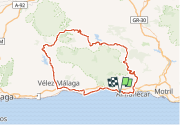
Trail Moto cross of 184 km to be discovered at Andalusia, Granada, Almuñécar. This trail is proposed by jpipacific.

Description

Honda Africa Twin CRF 1000 DCT en duo.
Début de balade par la magnifique route de las Cabras.
Visite d'un centre d'observation astronomique (Sky Andaluz Astrotourism) non loin de Jàtar.
Nous avons mangé à Alhama de Granada. Bonnes tapas surtout "El Choto".
Passage en piste à Venta de Zafarraya.
Fin de rando par le bord de mer.

Elevation profile

Photos

Positioning

Country:
Spain
Region :
Andalusia
Department/Province :
Granada
Municipality :
Almuñécar
Location:
Unknown
Start:(UTM)
432133 ; 4066121 (30S) N.


Close
My subscriptions