Trail  Librilla - 2022-10-25_13h35m23_track_20221012_134924_el_berro_murcia_part_2 - Photo

2022-10-25_13h35m23_track_20221012_134924_el_berro_murcia_part_2

 vcoget
vcoget

User

© OpenStreetMap contributors
Length
Length
33 km
Max alt
Max alt
259 m
Uphill gradient
Uphill gradient
297 m
Km-Effort
Km-Effort  
37 km
Min alt
Min alt
34 m
Downhill gradient
Downhill gradient
480 m
Boucle
Boucle
No
Creation date :
2022-10-25 11:35:24.066
Updated on :
2022-10-25 11:35:27.406

(0 Reviews)


Scan this QR Code to open this trail in the SityTrail application

FREE GPS app for hiking

Logo SityTrail SityTrail

IGN / Geographical institutes

Download SityTrail from the App Store Download SityTrail from Google Play

Logo SityTrail SityTrail World

The world is yours!

Download SityTrail from the App Store Download SityTrail from Google Play Download SityTrail on Huawei AppGallery

About

Trail of 33 km to be discovered at Region of Murcia, Region of Murcia, Librilla. This trail is proposed by vcoget.

Description

Trace AlpineQuest 12/10/22 13:49:24

Elevation profile

Positioning

Country:
Spain
Region :
Region of Murcia
Department/Province :
Region of Murcia
Municipality :
Librilla
Location:
Unknown
Start:(UTM)
642996 ; 4195090 (30S) N.

Trails nearby

Trail sport Librilla - 2022-10-25_08h46m53_track_20221012_134924_el_berro_murcia_part_2 - Photo
sport
vcoget

sport

Very easy
Librilla, Region of Murcia, Region of Murcia, Spain
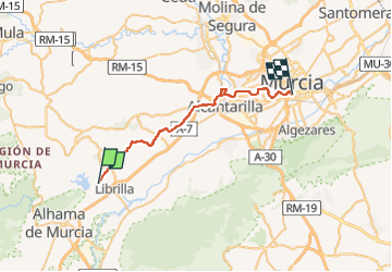
33 km | 37 km-effort
Unknown
No


Close
My subscriptions