


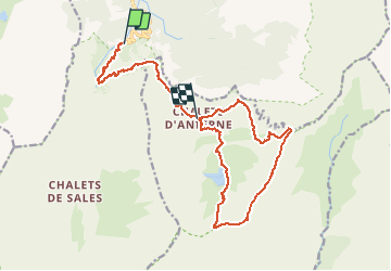
Lignon / Col d'Anterne / Tête de Moëde / Tête de Villy / Lignon

svp59
User

Length
18.2 km

Max alt
2474 m

Uphill gradient
1448 m
Km-Effort
35 km

Min alt
1185 m

Downhill gradient
824 m
Boucle
No
Creation date :
2014-12-10 00:00:00.0
Updated on :
2014-12-10 00:00:00.0
7h26
Difficulty : Medium

FREE GPS app for hiking
 SityTrail
IGN / Geographical institutes
SityTrail Plus
The world is yours!
About
Trail Walking of 18.2 km to be discovered at Auvergne-Rhône-Alpes, Upper Savoy, Sixt-Fer-à-Cheval. This trail is proposed by svp59.
Description
Le guide s'arrête dans la descente au refuge d'Anterne Alfred Wills ( plus de batterie ) . Rajouter 6km , 50 m de D et 650 m de D- pour l 'arrivée au Lignon et 90 mn
Photos


Positioning
Country:
France
Region :
Auvergne-Rhône-Alpes
Department/Province :
Upper Savoy
Municipality :
Sixt-Fer-à-Cheval
Location:
Unknown
Start:(Dec)
Start:(UTM)
327243 ; 5098822 (32T) N.
Comments