


l'huveaune

cousam
User
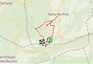

Length
15.4 km

Max alt
706 m

Uphill gradient
695 m
Km-Effort
25 km

Min alt
397 m

Downhill gradient
694 m
Boucle
Yes
Creation date :
2022-10-26 07:05:44.42
Updated on :
2022-10-26 20:15:01.587
7h52
Difficulty : Very difficult

FREE GPS app for hiking
 SityTrail
IGN / Geographical institutes
SityTrail Plus
The world is yours!
About
Trail Walking of 15.4 km to be discovered at Provence-Alpes-Côte d'Azur, Var, Plan-d'Aups-Sainte-Baume. This trail is proposed by cousam.
Description
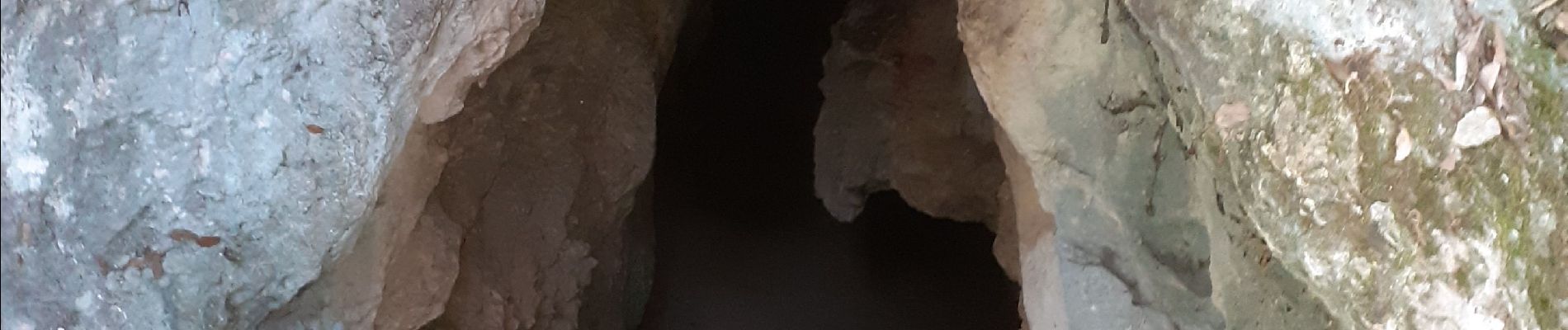
Pas d'eau dans les vasques (octobre 2022)
Photos


Positioning
Country:
France
Region :
Provence-Alpes-Côte d'Azur
Department/Province :
Var
Municipality :
Plan-d'Aups-Sainte-Baume
Location:
Unknown
Start:(Dec)
Start:(UTM)
724334 ; 4802526 (31T) N.
Comments