Trail Walking Moëlan-sur-Mer - Le belon terre et mer - Photo

Le belon terre et mer

© OpenStreetMap contributors
Length
Length
11.2 km
Max alt
Max alt
43 m
Uphill gradient
Uphill gradient
121 m
Km-Effort
Km-Effort  
12.8 km
Min alt
Min alt
-2 m
Downhill gradient
Downhill gradient
124 m
Boucle
Boucle
Yes
Creation date :
2022-10-30 09:51:27.0
Updated on :
2022-10-30 14:52:18.177

(0 Reviews)

Walking
Walking
2h48
Difficulty : Easy

Scan this QR Code to open this trail in the SityTrail application

FREE GPS app for hiking

Logo SityTrail SityTrail

IGN / Geographical institutes

Download SityTrail from the App Store Download SityTrail from Google Play

Logo SityTrail SityTrail Plus

The world is yours!

Download SityTrail from the App Store Download SityTrail from Google Play Download SityTrail on Huawei AppGallery

About

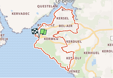
Trail Walking of 11.2 km to be discovered at Brittany, Finistère, Moëlan-sur-Mer. This trail is proposed by dlenaour56.

Description

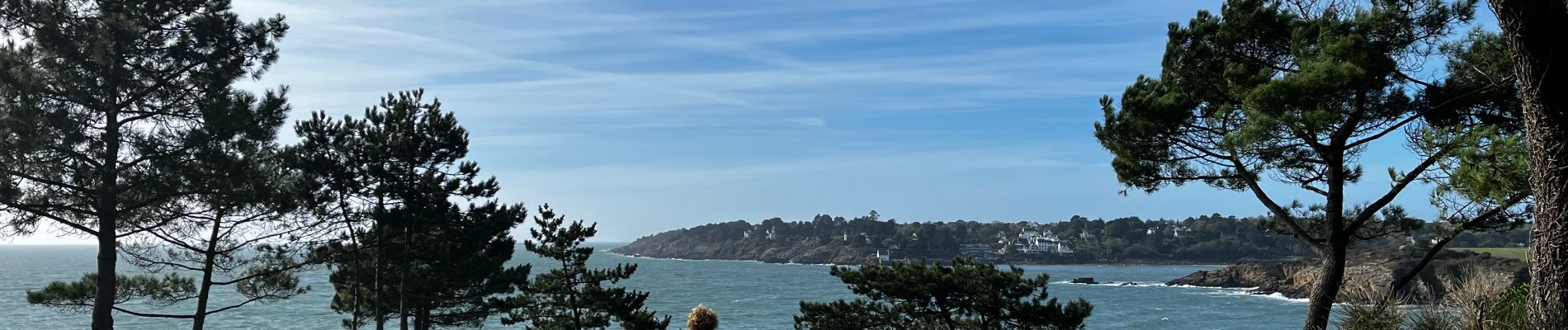
La rivière du belon est célèbre pour ses huîtres plates au goût de noisette.
La randonnée mêle une première partie océanique, puis un tronçon côté campagne , pour finir par le chemin côtier le long du belon en commençant par la très belle anse de Lanriot. La randonnée débute et se finit sur la plage de kerfany. Très agréable sur tout le parcours.

Elevation profile

Photos

Positioning

Country:
France
Region :
Brittany
Department/Province :
Finistère
Municipality :
Moëlan-sur-Mer
Location:
Unknown
Start:(UTM)
446079 ; 5294465 (30T) N.


Close
My subscriptions