


gages

lablaquiere
User
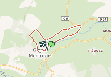

Length
6.5 km

Max alt
635 m

Uphill gradient
125 m
Km-Effort
8.1 km

Min alt
551 m

Downhill gradient
123 m
Boucle
Yes
Creation date :
2022-10-30 14:03:41.504
Updated on :
2022-10-30 15:40:57.346
1h28
Difficulty : Medium

FREE GPS app for hiking
 SityTrail
IGN / Geographical institutes
SityTrail Plus
The world is yours!
About
Trail Walking of 6.5 km to be discovered at Occitania, Aveyron, Montrozier. This trail is proposed by lablaquiere.
Positioning
Country:
France
Region :
Occitania
Department/Province :
Aveyron
Municipality :
Montrozier
Location:
Unknown
Start:(Dec)
Start:(UTM)
476842 ; 4916128 (31T) N.
Comments