


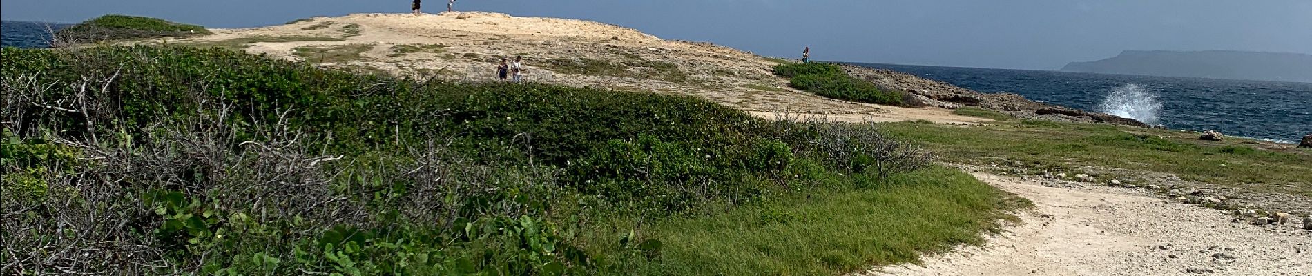
Pointe dès châteaux

sameja
User
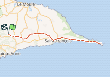

Length
50 km

Max alt
65 m

Uphill gradient
470 m
Km-Effort
56 km

Min alt
-2 m

Downhill gradient
470 m
Boucle
Yes
Creation date :
2022-11-01 12:17:58.0
Updated on :
2022-11-01 15:20:06.07
2h33
Difficulty : Medium

FREE GPS app for hiking
 SityTrail
IGN / Geographical institutes
SityTrail Plus
The world is yours!
About
Trail Road bike of 50 km to be discovered at Guadeloupe, Unknown, Sainte-Anne. This trail is proposed by sameja.
Description
Liards saint Robert
Photos


Positioning
Country:
France
Region :
Guadeloupe
Department/Province :
Unknown
Municipality :
Sainte-Anne
Location:
Unknown
Start:(Dec)
Start:(UTM)
672426 ; 1799147 (20Q) N.
Comments