


chemin des cascades 2014

cemoi
User
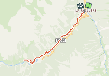

Length
11.4 km

Max alt
1550 m

Uphill gradient
509 m
Km-Effort
18.2 km

Min alt
1059 m

Downhill gradient
521 m
Boucle
Yes
Creation date :
2019-06-18 08:26:55.675
Updated on :
2020-04-24 08:02:37.336
3h33
Difficulty : Unknown

FREE GPS app for hiking
 SityTrail
IGN / Geographical institutes
SityTrail Plus
The world is yours!
About
Trail Walking of 11.4 km to be discovered at Occitania, Hautespyrenees, Cauterets. This trail is proposed by cemoi.
Description
Rando facile
Positioning
Country:
France
Region :
Occitania
Department/Province :
Hautespyrenees
Municipality :
Cauterets
Location:
Unknown
Start:(Dec)
Start:(UTM)
736034 ; 4750700 (30T) N.
Comments