


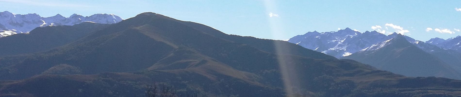
Pic du Ger

chasle
User
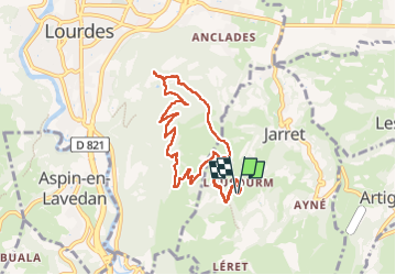

Length
9.5 km

Max alt
942 m

Uphill gradient
486 m
Km-Effort
15.9 km

Min alt
586 m

Downhill gradient
486 m
Boucle
Yes
Creation date :
2022-11-06 08:41:40.548
Updated on :
2022-11-06 14:35:00.847
3h12
Difficulty : Easy

FREE GPS app for hiking
 SityTrail
IGN / Geographical institutes
SityTrail Plus
The world is yours!
About
Trail Walking of 9.5 km to be discovered at Occitania, Hautespyrenees, Jarret. This trail is proposed by chasle.
Photos


Positioning
Country:
France
Region :
Occitania
Department/Province :
Hautespyrenees
Municipality :
Jarret
Location:
Unknown
Start:(Dec)
Start:(UTM)
742466 ; 4773504 (30T) N.
Comments