


Port de Lers, col de Port D+1800m

ericberlin
User

Length
75 km

Max alt
1521 m

Uphill gradient
1868 m
Km-Effort
100 km

Min alt
470 m

Downhill gradient
1868 m
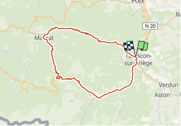
Boucle
Yes
Creation date :
2022-11-08 10:36:47.732
Updated on :
2023-06-05 15:03:21.784
6h02
Difficulty : Very difficult

FREE GPS app for hiking
 SityTrail
IGN / Geographical institutes
SityTrail Plus
The world is yours!
About
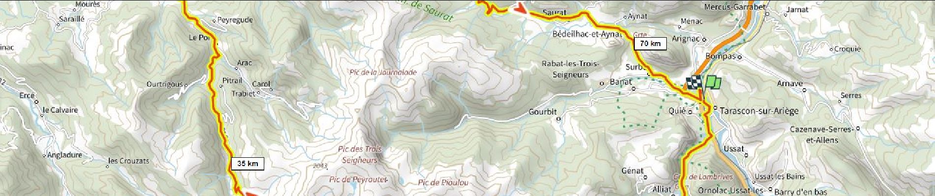
Trail Road bike of 75 km to be discovered at Occitania, Ariège, Tarascon-sur-Ariège. This trail is proposed by ericberlin.
Description
Une classique magnifique autour du massif des 3 Seigneurs.
En saison, bar-restaurant à l' étang de Lers, Massat, col de Port.
Que des petites routes!
Photos

Positioning
Country:
France
Region :
Occitania
Department/Province :
Ariège
Municipality :
Tarascon-sur-Ariège
Location:
Unknown
Start:(Dec)
Start:(UTM)
385646 ; 4745088 (31T) N.
Comments