


sortie trail SLDP

choubaka77
User

Length
15.9 km

Max alt
604 m

Uphill gradient
324 m
Km-Effort
20 km

Min alt
397 m

Downhill gradient
324 m
Boucle
Yes
Creation date :
2022-11-10 06:47:38.191
Updated on :
2022-11-10 06:49:18.245
4h00
Difficulty : Medium

FREE GPS app for hiking
 SityTrail
IGN / Geographical institutes
SityTrail Plus
The world is yours!
About
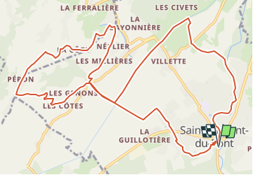
Trail Running of 15.9 km to be discovered at Auvergne-Rhône-Alpes, Isère, Saint-Laurent-du-Pont. This trail is proposed by choubaka77.
Description
petites routes et chemin pour cette sortie trail.
Positioning
Country:
France
Region :
Auvergne-Rhône-Alpes
Department/Province :
Isère
Municipality :
Saint-Laurent-du-Pont
Location:
Unknown
Start:(Dec)
Start:(UTM)
714157 ; 5029449 (31T) N.
Comments