


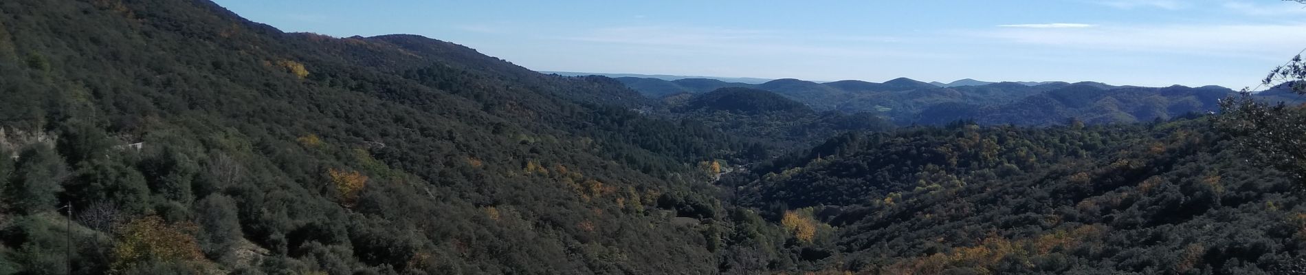
Mont Brion - La Salindrinque

ARVIEU
User

Length
17.1 km

Max alt
811 m

Uphill gradient
797 m
Km-Effort
28 km

Min alt
391 m

Downhill gradient
797 m
Boucle
Yes
Creation date :
2022-11-11 06:43:26.618
Updated on :
2022-11-11 06:46:05.109
6h00
Difficulty : Difficult

FREE GPS app for hiking
 SityTrail
IGN / Geographical institutes
SityTrail Plus
The world is yours!
About
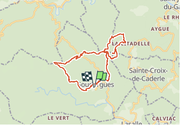
Trail Walking of 17.1 km to be discovered at Occitania, Gard, Soudorgues. This trail is proposed by ARVIEU.
Photos

Positioning
Country:
France
Region :
Occitania
Department/Province :
Gard
Municipality :
Soudorgues
Location:
Unknown
Start:(Dec)
Start:(UTM)
566379 ; 4879247 (31T) N.
Comments