


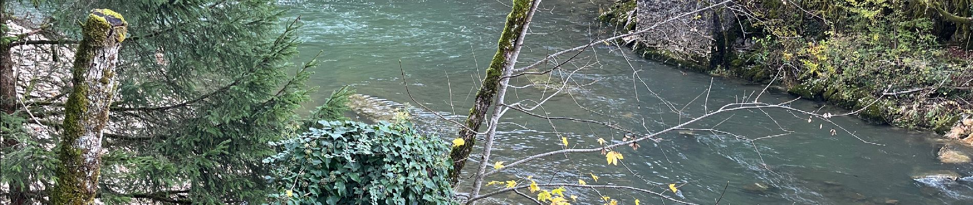
Tout de l’Oignin

GioA10
User
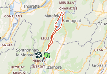

Length
13 km

Max alt
451 m

Uphill gradient
211 m
Km-Effort
15.8 km

Min alt
380 m

Downhill gradient
211 m
Boucle
Yes
Creation date :
2022-11-11 09:49:48.0
Updated on :
2022-11-11 15:06:25.018
4h06
Difficulty : Easy

FREE GPS app for hiking
 SityTrail
IGN / Geographical institutes
SityTrail Plus
The world is yours!
About
Trail Walking of 13 km to be discovered at Auvergne-Rhône-Alpes, Ain, Izernore. This trail is proposed by GioA10.
Photos


Positioning
Country:
France
Region :
Auvergne-Rhône-Alpes
Department/Province :
Ain
Municipality :
Izernore
Location:
Unknown
Start:(Dec)
Start:(UTM)
696047 ; 5122174 (31T) N.
Comments