


Sénépi

Liebeaux
User

Length
16.2 km

Max alt
1766 m

Uphill gradient
915 m
Km-Effort
28 km

Min alt
879 m

Downhill gradient
914 m
Boucle
Yes
Creation date :
2022-11-17 08:04:27.737
Updated on :
2022-11-17 14:40:45.814
6h35
Difficulty : Very difficult

FREE GPS app for hiking
 SityTrail
IGN / Geographical institutes
SityTrail Plus
The world is yours!
About
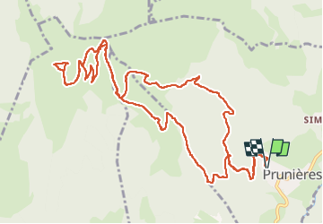
Trail Walking of 16.2 km to be discovered at Auvergne-Rhône-Alpes, Isère, Prunières. This trail is proposed by Liebeaux.
Positioning
Country:
France
Region :
Auvergne-Rhône-Alpes
Department/Province :
Isère
Municipality :
Prunières
Location:
Unknown
Start:(Dec)
Start:(UTM)
717912 ; 4974888 (31T) N.
Comments