Trail Mountain bike Alzonne - canal royal par la foret du malpère - Photo

canal royal par la foret du malpère

 leroj73
leroj73

User

© OpenStreetMap contributors
Length
Length
34 km
Max alt
Max alt
417 m
Uphill gradient
Uphill gradient
518 m
Km-Effort
Km-Effort  
41 km
Min alt
Min alt
120 m
Downhill gradient
Downhill gradient
520 m
Boucle
Boucle
Yes
Creation date :
2022-11-19 17:35:42.516
Updated on :
2022-11-19 17:40:13.219

(0 Reviews)

Mountain bike
Mountain bike
2h48
Difficulty : Difficult

Scan this QR Code to open this trail in the SityTrail application

FREE GPS app for hiking

Logo SityTrail SityTrail

IGN / Geographical institutes

Download SityTrail from the App Store Download SityTrail from Google Play

Logo SityTrail SityTrail World

The world is yours!

Download SityTrail from the App Store Download SityTrail from Google Play Download SityTrail on Huawei AppGallery

About

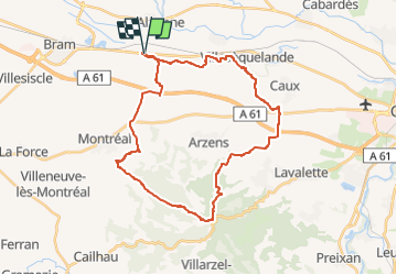
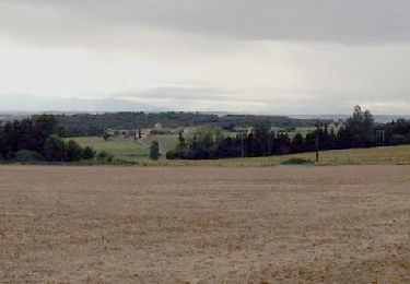
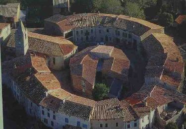
Trail Mountain bike of 34 km to be discovered at Occitania, Aude, Alzonne. This trail is proposed by leroj73.

Description

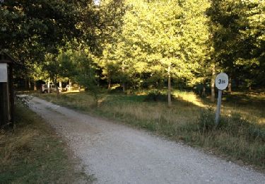
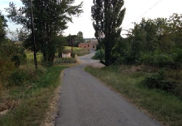
trace sur le canal très roulante. pas de difficultés majeures sur ascension et descente, chemin large

Elevation profile

Positioning

Country:
France
Region :
Occitania
Department/Province :
Aude
Municipality :
Alzonne
Location:
Unknown
Start:(UTM)
432476 ; 4787735 (31T) N.

Trails nearby

Trail Walking Moussoulens - Boucle de la Combe a la Biterelle  - Photo
Walking
livfoss

Walking

Easy
(1)
Moussoulens, Occitania, Aude, France
7.1 km | 8.6 km-effort
1h 50min
No
Trail Walking Raissac-sur-Lampy - Raissac to Villelongue via La Combe Belle - Photo
Walking
livfoss

Walking

Medium
Raissac-sur-Lampy, Occitania, Aude, France
13.4 km | 16.9 km-effort
3h 38min
Yes
Trail Walking Raissac-sur-Lampy - Raissac to Villelongue via La Combe Belle - Photo
Walking
livfoss

Walking

Medium
Raissac-sur-Lampy, Occitania, Aude, France
13.4 km | 16.8 km-effort
3h 38min
Yes
Trail Walking Raissac-sur-Lampy - Raissac to Villelongue via La Combe Belle - Photo
Walking
livfoss

Walking

Medium
Raissac-sur-Lampy, Occitania, Aude, France
13.4 km | 16.9 km-effort
3h 38min
Yes
Trail Walking Raissac-sur-Lampy - Pacerpoles First Outing - Photo
Walking
livfoss

Walking

Easy
(1)
Raissac-sur-Lampy, Occitania, Aude, France
11.2 km | 13.5 km-effort
2h 57min
Yes
Trail Walking Arzens - Chemin du Piémont Pyrénéen - Arzens à Fanjeaux - Photo
Walking
tracegps

Walking

Difficult
Arzens, Occitania, Aude, France
18.7 km | 24 km-effort
6h 0min
No
Trail Walking Montréal - Petit tour Montréal Est - Photo
Walking
geli.henri

Walking

Easy
Montréal, Occitania, Aude, France
3.2 km | 4.2 km-effort
90h 39min
Yes
Trail Walking Montréal - Les bois du Chapitre Montrŕal d'aude - Photo
Walking
geli.henri

Walking

Medium
Montréal, Occitania, Aude, France
7.5 km | 9.6 km-effort
34h 17min
Yes
Trail Walking Montréal - Compost.Montré-Hounoux 2 - Photo
Walking
ColetteDocteur

Walking

Very difficult
Montréal, Occitania, Aude, France
20 km | 26 km-effort
5h 59min
No


Close
My subscriptions