


le grand Delmas (AS)

TOULAUDIN
User


6h16
Difficulty : Difficult

FREE GPS app for hiking
 SityTrail
IGN / Geographical institutes
SityTrail Plus
The world is yours!
About
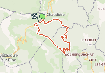
Trail Walking of 16.9 km to be discovered at Auvergne-Rhône-Alpes, Drôme, Bézaudun-sur-Bîne. This trail is proposed by TOULAUDIN.
Description
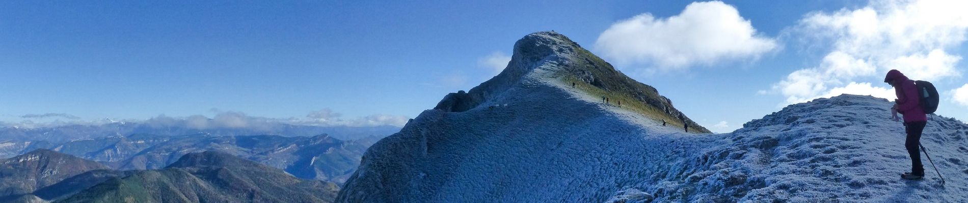
trace rando effectuée le 20 nov 2022 avec le club ASPTT VALENCE. très beau parcours pas de difficulté si ce n'est la montée et plusieurs montées sur le retour " être vigilant sur la crête "
le retour côté Est est plus intéressant que le côté Sud , vue sur le Dévoluy et le Veymont ( voir photos) et sur la fin du parcours belle vue sur les 3 Becs et la Chaudière , à noter la dernière montée
dans la marne un peu galère car c'était très humide et collant
Photos
 - Photo 1")
 - Photo 2")
 - Photo 3")
 - Photo 4")
 - Photo 5")
 - Photo 6")
 - Photo 7")
 - Photo 8")
 - Photo 9")
 - Photo 10")
Positioning
Comments