


Gorges du Verdon - de Point Sublime vers Encastel - AR

Orcal37
User GUIDE
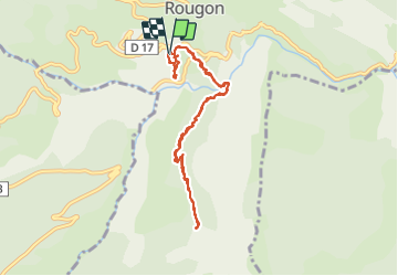

Length
9.3 km

Max alt
1056 m

Uphill gradient
698 m
Km-Effort
18.6 km

Min alt
624 m

Downhill gradient
695 m
Boucle
Yes
Creation date :
2014-12-10 00:00:00.0
Updated on :
2021-09-10 15:57:26.631
3h15
Difficulty : Medium

FREE GPS app for hiking
 SityTrail
IGN / Geographical institutes
SityTrail Plus
The world is yours!
About
Trail Walking of 9.3 km to be discovered at Provence-Alpes-Côte d'Azur, Alpes-de-Haute-Provence, Rougon. This trail is proposed by Orcal37.
Description
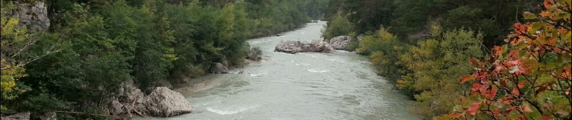
Gorges du Verdon - de Point Sublime vers Encastel - AR ; jour de pluie
Photos


Positioning
Country:
France
Region :
Provence-Alpes-Côte d'Azur
Department/Province :
Alpes-de-Haute-Provence
Municipality :
Rougon
Location:
Unknown
Start:(Dec)
Start:(UTM)
290694 ; 4852247 (32T) N.
Comments
Fort ds les bois et point d’arrivée frustrant sans vue.