Trail Walking Vif - Matheysine Échaillon Le Pieu - Photo

Matheysine Échaillon Le Pieu

 c.gourme
c.gourme

User

© OpenStreetMap contributors
Length
Length
13.5 km
Max alt
Max alt
1247 m
Uphill gradient
Uphill gradient
988 m
Km-Effort
Km-Effort  
27 km
Min alt
Min alt
309 m
Downhill gradient
Downhill gradient
987 m
Boucle
Boucle
No
Creation date :
2022-11-25 07:49:17.0
Updated on :
2022-11-27 19:46:21.145

(0 Reviews)

Walking
Walking
5h12
Difficulty : Difficult

Scan this QR Code to open this trail in the SityTrail application

FREE GPS app for hiking

Logo SityTrail SityTrail

IGN / Geographical institutes

Download SityTrail from the App Store Download SityTrail from Google Play

Logo SityTrail SityTrail Plus

The world is yours!

Download SityTrail from the App Store Download SityTrail from Google Play Download SityTrail on Huawei AppGallery

About

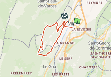
Trail Walking of 13.5 km to be discovered at Auvergne-Rhône-Alpes, Isère, Vif. This trail is proposed by c.gourme.

Description

Depuis le sommet ne pas redescendre directement par le chemin marqué en vert (c'est la trace): trop raide, on peut à la limite monter par ce chemin après une période sèche.
Depuis le sommet  revenir en arrière et prendre à droite le chemin qui coupe vers Les Perrins.

Elevation profile

Positioning

Country:
France
Region :
Auvergne-Rhône-Alpes
Department/Province :
Isère
Municipality :
Vif
Location:
Unknown
Start:(UTM)
710358 ; 4992242 (31T) N.


Close
My subscriptions