


Malaucene

Roger Philippe Wallez
User GUIDE
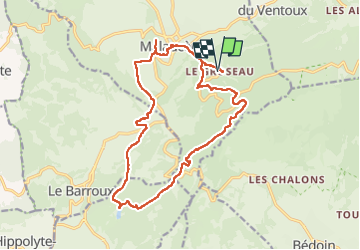

Length
19.2 km

Max alt
699 m

Uphill gradient
667 m
Km-Effort
28 km

Min alt
299 m

Downhill gradient
668 m
Boucle
Yes
Creation date :
2022-11-20 08:41:59.0
Updated on :
2022-11-26 08:10:30.807
6h13
Difficulty : Very difficult

FREE GPS app for hiking
 SityTrail
IGN / Geographical institutes
SityTrail Plus
The world is yours!
About
Trail Walking of 19.2 km to be discovered at Provence-Alpes-Côte d'Azur, Vaucluse, Malaucène. This trail is proposed by Roger Philippe Wallez.
Positioning
Country:
France
Region :
Provence-Alpes-Côte d'Azur
Department/Province :
Vaucluse
Municipality :
Malaucène
Location:
Unknown
Start:(Dec)
Start:(UTM)
671710 ; 4892707 (31T) N.
Comments