


Forêt d'Echallon, de Belleydoux

HB01
User
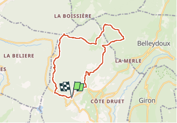

Length
16.6 km

Max alt
1061 m

Uphill gradient
519 m
Km-Effort
24 km

Min alt
819 m

Downhill gradient
522 m
Boucle
Yes
Creation date :
2022-11-27 07:37:52.711
Updated on :
2022-11-27 13:17:49.27
4h31
Difficulty : Medium

FREE GPS app for hiking
 SityTrail
IGN / Geographical institutes
SityTrail Plus
The world is yours!
About
Trail Walking of 16.6 km to be discovered at Auvergne-Rhône-Alpes, Ain, Échallon. This trail is proposed by HB01.
Description
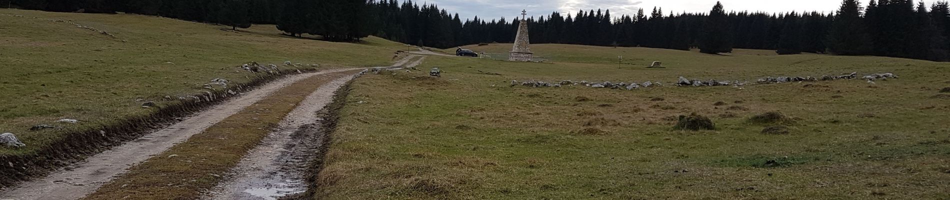
Départ carrefour routes Oyonnax et Echallon. Passages (2 km) très boueux ce jour.
Photos

Positioning
Country:
France
Region :
Auvergne-Rhône-Alpes
Department/Province :
Ain
Municipality :
Échallon
Location:
Unknown
Start:(Dec)
Start:(UTM)
709776 ; 5122783 (31T) N.
Comments