


Cabane de Tabe

lebarça
User

Length
8.5 km

Max alt
1584 m

Uphill gradient
717 m
Km-Effort
18 km

Min alt
861 m

Downhill gradient
717 m
Boucle
Yes
Creation date :
2022-11-27 08:04:03.0
Updated on :
2022-11-27 13:54:41.919
5h45
Difficulty : Easy

FREE GPS app for hiking
 SityTrail
IGN / Geographical institutes
SityTrail Plus
The world is yours!
About
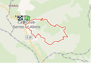
Trail Walking of 8.5 km to be discovered at Occitania, Ariège, Cazenave-Serres-et-Allens. This trail is proposed by lebarça.
Positioning
Country:
France
Region :
Occitania
Department/Province :
Ariège
Municipality :
Cazenave-Serres-et-Allens
Location:
Unknown
Start:(Dec)
Start:(UTM)
391389 ; 4743954 (31T) N.
Comments