


CRUIS . JAS ROCHE . ND DE LURE .O L S

RobinMicheline
User GUIDE
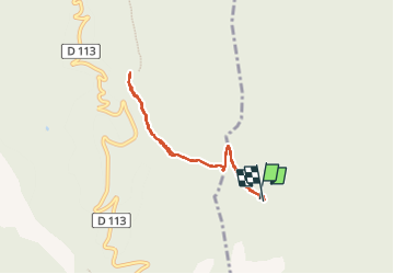

Length
6.7 km

Max alt
1249 m

Uphill gradient
245 m
Km-Effort
10 km

Min alt
1043 m

Downhill gradient
253 m
Boucle
Yes
Creation date :
2022-11-27 12:49:22.301
Updated on :
2022-11-27 16:22:33.814
2h24
Difficulty : Easy

FREE GPS app for hiking
 SityTrail
IGN / Geographical institutes
SityTrail Plus
The world is yours!
About
Trail Walking of 6.7 km to be discovered at Provence-Alpes-Côte d'Azur, Alpes-de-Haute-Provence, Cruis. This trail is proposed by RobinMicheline.
Photos


Positioning
Country:
France
Region :
Provence-Alpes-Côte d'Azur
Department/Province :
Alpes-de-Haute-Provence
Municipality :
Cruis
Location:
Unknown
Start:(Dec)
Start:(UTM)
725184 ; 4884919 (31T) N.
Comments