


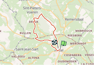
Aubel Fourons

JLBragard
User

Length
11 km

Max alt
286 m

Uphill gradient
238 m
Km-Effort
14.2 km

Min alt
175 m

Downhill gradient
241 m
Boucle
Yes
Creation date :
2022-11-23 12:28:14.836
Updated on :
2022-11-29 12:15:26.934
2h11
Difficulty : Medium

FREE GPS app for hiking
 SityTrail
IGN / Geographical institutes
SityTrail Plus
The world is yours!
About
Trail Walking of 11 km to be discovered at Wallonia, Liège, Aubel. This trail is proposed by JLBragard.
Positioning
Country:
Belgium
Region :
Wallonia
Department/Province :
Liège
Municipality :
Aubel
Location:
Unknown
Start:(Dec)
Start:(UTM)
701953 ; 5620930 (31U) N.
Comments