


GR 10 11

chasle
User

Length
18.7 km

Max alt
2190 m

Uphill gradient
1657 m
Km-Effort
38 km

Min alt
613 m

Downhill gradient
752 m
Boucle
No
Creation date :
2022-11-29 18:57:09.592
Updated on :
2022-11-29 19:04:18.638
8h34
Difficulty : Difficult

FREE GPS app for hiking
 SityTrail
IGN / Geographical institutes
SityTrail Plus
The world is yours!
About
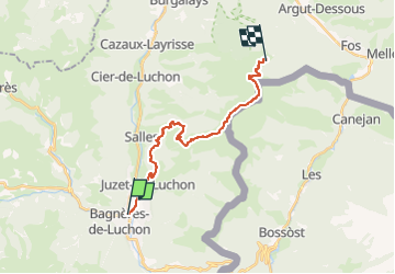
Trail Walking of 18.7 km to be discovered at Occitania, Haute-Garonne, Bagnères-de-Luchon. This trail is proposed by chasle.
Positioning
Country:
France
Region :
Occitania
Department/Province :
Haute-Garonne
Municipality :
Bagnères-de-Luchon
Location:
Unknown
Start:(Dec)
Start:(UTM)
303444 ; 4740791 (31T) N.
Comments