Trail Walking Sauxillanges - 
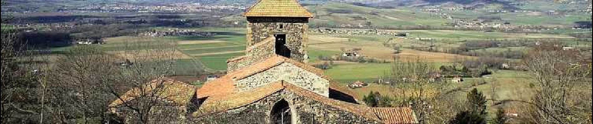
Sauxillanges_Sentier_Claire - Photo
 jagarnier
jagarnier

User GUIDE

© OpenStreetMap contributors
Length
Length
11.3 km
Max alt
Max alt
616 m
Uphill gradient
Uphill gradient
322 m
Km-Effort
Km-Effort  
15.6 km
Min alt
Min alt
418 m
Downhill gradient
Downhill gradient
322 m
Boucle
Boucle
Yes
Creation date :
2022-12-01 06:47:44.379
Updated on :
2023-04-10 13:12:46.656

(0 Reviews)

Walking
Walking
3h30
Difficulty : Medium

Scan this QR Code to open this trail in the SityTrail application

FREE GPS app for hiking

Logo SityTrail SityTrail

IGN / Geographical institutes

Download SityTrail from the App Store Download SityTrail from Google Play

Logo SityTrail SityTrail Plus

The world is yours!

Download SityTrail from the App Store Download SityTrail from Google Play Download SityTrail on Huawei AppGallery

About

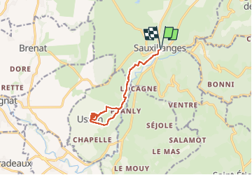
Trail Walking of 11.3 km to be discovered at Auvergne-Rhône-Alpes, Puy-de-Dôme, Sauxillanges. This trail is proposed by jagarnier.

Description

Au cours de cette randonnée, vous découvrirez un sentier sauvage qui relie un site clunisien au volcan de l'un des plus beaux villages de France. Une fois à Usson, vous pourrez admirer un paysage à 360° depuis le haut de la butte.

Elevation profile

Photos

Positioning

Country:
France
Region :
Auvergne-Rhône-Alpes
Department/Province :
Puy-de-Dôme
Municipality :
Sauxillanges
Location:
Unknown
Start:(UTM)
529090 ; 5044251 (31T) N.


Close
My subscriptions