


Chartreuse Belvédère des sangles

c.gourme
User
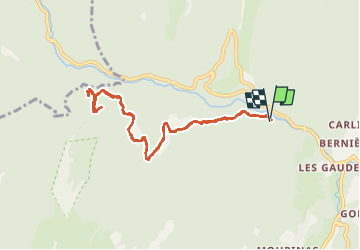

Length
10.1 km

Max alt
1089 m

Uphill gradient
422 m
Km-Effort
15.6 km

Min alt
773 m

Downhill gradient
409 m
Boucle
Yes
Creation date :
2022-12-01 10:23:56.0
Updated on :
2023-02-27 08:28:33.114
3h26
Difficulty : Easy

FREE GPS app for hiking
 SityTrail
IGN / Geographical institutes
SityTrail Plus
The world is yours!
About
Trail Walking of 10.1 km to be discovered at Auvergne-Rhône-Alpes, Isère, Saint-Pierre-de-Chartreuse. This trail is proposed by c.gourme.
Positioning
Country:
France
Region :
Auvergne-Rhône-Alpes
Department/Province :
Isère
Municipality :
Saint-Pierre-de-Chartreuse
Location:
Unknown
Start:(Dec)
Start:(UTM)
718964 ; 5025098 (31T) N.
Comments