


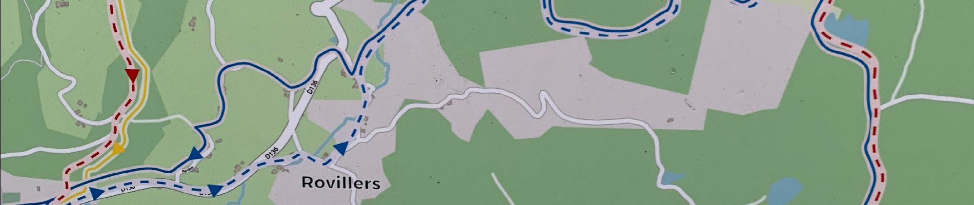
Saint-Brssson : circuit du Beviau

Silke Roth
User
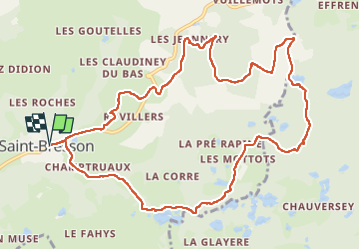

Length
12.1 km

Max alt
641 m

Uphill gradient
294 m
Km-Effort
16 km

Min alt
427 m

Downhill gradient
293 m
Boucle
Yes
Creation date :
2022-12-03 10:48:25.0
Updated on :
2022-12-03 15:24:12.59
3h35
Difficulty : Easy

FREE GPS app for hiking
 SityTrail
IGN / Geographical institutes
SityTrail Plus
The world is yours!
About
Trail Walking of 12.1 km to be discovered at Bourgogne-Franche-Comté, Haute-Saône, Saint-Bresson. This trail is proposed by Silke Roth.
Photos


Positioning
Country:
France
Region :
Bourgogne-Franche-Comté
Department/Province :
Haute-Saône
Municipality :
Saint-Bresson
Location:
Unknown
Start:(Dec)
Start:(UTM)
313625 ; 5304853 (32T) N.
Comments