


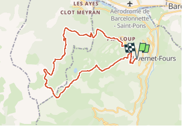
Les Molanes - Col des Thuiles

patbt
User

Length
20 km

Max alt
2404 m

Uphill gradient
1126 m
Km-Effort
35 km

Min alt
1502 m

Downhill gradient
1139 m
Boucle
Yes
Creation date :
2022-08-12 08:33:56.433
Updated on :
2022-12-04 11:24:32.029
5h12
Difficulty : Medium

FREE GPS app for hiking
 SityTrail
IGN / Geographical institutes
SityTrail Plus
The world is yours!
About
Trail Walking of 20 km to be discovered at Provence-Alpes-Côte d'Azur, Alpes-de-Haute-Provence, Uvernet-Fours. This trail is proposed by patbt.
Positioning
Country:
France
Region :
Provence-Alpes-Côte d'Azur
Department/Province :
Alpes-de-Haute-Provence
Municipality :
Uvernet-Fours
Location:
Unknown
Start:(Dec)
Start:(UTM)
309818 ; 4914649 (32T) N.
Comments