


ND des Neiges

Léger Michel
User
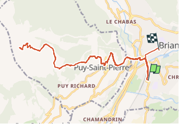

Length
14.5 km

Max alt
2296 m

Uphill gradient
1142 m
Km-Effort
30 km

Min alt
1203 m

Downhill gradient
1102 m
Boucle
No
Creation date :
2022-12-04 07:57:29.146
Updated on :
2022-12-04 14:38:54.72
6h39
Difficulty : Very difficult

FREE GPS app for hiking
 SityTrail
IGN / Geographical institutes
SityTrail Plus
The world is yours!
About
Trail Walking of 14.5 km to be discovered at Provence-Alpes-Côte d'Azur, Hautes-Alpes, Briançon. This trail is proposed by Léger Michel.
Description
Animateur, j'ai conduit Bruno depuis la MJC, et Christian Euveq, Patrick Billes (mon voisin), et M. et Mme ? depuis Puy-Saint-Pierre.
Positioning
Country:
France
Region :
Provence-Alpes-Côte d'Azur
Department/Province :
Hautes-Alpes
Municipality :
Briançon
Location:
Unknown
Start:(Dec)
Start:(UTM)
313165 ; 4973437 (32T) N.
Comments