


ste Pazanne - étang de la Beusse

Fauvette 44
User
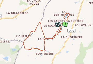

Length
9 km

Max alt
34 m

Uphill gradient
54 m
Km-Effort
9.7 km

Min alt
13 m

Downhill gradient
55 m
Boucle
Yes
Creation date :
2022-12-04 13:03:56.847
Updated on :
2022-12-04 15:29:33.127
2h09
Difficulty : Medium

FREE GPS app for hiking
 SityTrail
IGN / Geographical institutes
SityTrail Plus
The world is yours!
About
Trail Walking of 9 km to be discovered at Pays de la Loire, Loire-Atlantique, Sainte-Pazanne. This trail is proposed by Fauvette 44.
Positioning
Country:
France
Region :
Pays de la Loire
Department/Province :
Loire-Atlantique
Municipality :
Sainte-Pazanne
Location:
Unknown
Start:(Dec)
Start:(UTM)
587768 ; 5213690 (30T) N.
Comments