


GR_70_AI_09_Pont-Monvert_Florac-3-Riveres_20140923

patrickdanilo
User

Length
19.5 km

Max alt
1421 m

Uphill gradient
588 m
Km-Effort
29 km

Min alt
537 m

Downhill gradient
1050 m
Boucle
No
Creation date :
2018-02-11 00:00:00.0
Updated on :
2022-11-03 14:32:08.8
5h00
Difficulty : Medium

FREE GPS app for hiking
 SityTrail
IGN / Geographical institutes
SityTrail Plus
The world is yours!
About
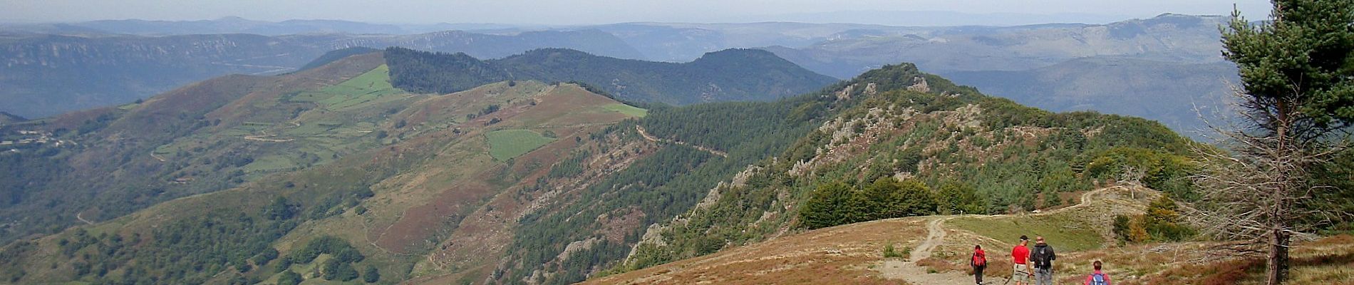
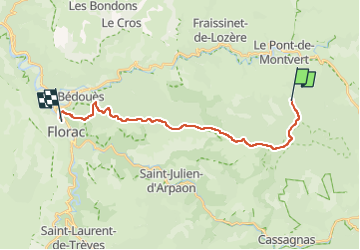
Trail Walking of 19.5 km to be discovered at Occitania, Lozère, Pont de Montvert - Sud Mont Lozère. This trail is proposed by patrickdanilo.
Description
Randonnée Marche de 20 km à découvrir à LE PONT-DE-MONTVERT, LOZERE, LANGUEDOC-ROUSSILLON. Cette randonnée est proposée par patrickdanilo
Photos


Positioning
Country:
France
Region :
Occitania
Department/Province :
Lozère
Municipality :
Pont de Montvert - Sud Mont Lozère
Location:
Le Pont-de-Montvert
Start:(Dec)
Start:(UTM)
559685 ; 4909819 (31T) N.
Comments