


GR 10 24

chasle
User
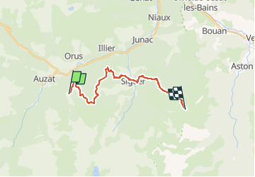

Length
18 km

Max alt
1903 m

Uphill gradient
1689 m
Km-Effort
38 km

Min alt
736 m

Downhill gradient
1003 m
Boucle
No
Creation date :
2022-12-07 10:30:28.302
Updated on :
2022-12-07 10:30:49.296
8h41
Difficulty : Difficult

FREE GPS app for hiking
 SityTrail
IGN / Geographical institutes
SityTrail Plus
The world is yours!
About
Trail Walking of 18 km to be discovered at Occitania, Ariège, Val-de-Sos. This trail is proposed by chasle.
Positioning
Country:
France
Region :
Occitania
Department/Province :
Ariège
Municipality :
Val-de-Sos
Location:
Unknown
Start:(Dec)
Start:(UTM)
377561 ; 4734612 (31T) N.
Comments