


zyy

Liebeaux
User

Length
2.9 km

Max alt
1089 m

Uphill gradient
350 m
Km-Effort
6.8 km

Min alt
776 m

Downhill gradient
110 m
Boucle
No
Creation date :
2022-12-08 07:56:16.821
Updated on :
2022-12-08 09:02:43.544
1h03
Difficulty : Medium

FREE GPS app for hiking
 SityTrail
IGN / Geographical institutes
SityTrail Plus
The world is yours!
About
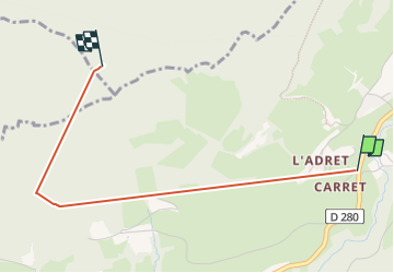
Trail Walking of 2.9 km to be discovered at Auvergne-Rhône-Alpes, Isère, Theys. This trail is proposed by Liebeaux.
Positioning
Country:
France
Region :
Auvergne-Rhône-Alpes
Department/Province :
Isère
Municipality :
Theys
Location:
Unknown
Start:(Dec)
Start:(UTM)
265555 ; 5022022 (32T) N.
Comments