


raquette à Lure

darranger
User
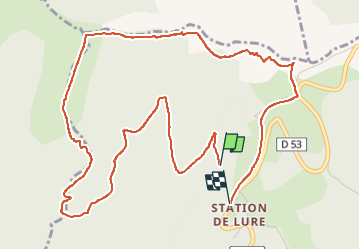

Length
6.9 km

Max alt
1724 m

Uphill gradient
317 m
Km-Effort
11 km

Min alt
1528 m

Downhill gradient
288 m
Boucle
No
Creation date :
2022-12-11 10:27:42.478
Updated on :
2022-12-11 14:31:42.275
2h17
Difficulty : Medium

FREE GPS app for hiking
 SityTrail
IGN / Geographical institutes
SityTrail Plus
The world is yours!
About
Trail Walking of 6.9 km to be discovered at Provence-Alpes-Côte d'Azur, Alpes-de-Haute-Provence, Saint-Étienne-les-Orgues. This trail is proposed by darranger.
Positioning
Country:
France
Region :
Provence-Alpes-Côte d'Azur
Department/Province :
Alpes-de-Haute-Provence
Municipality :
Saint-Étienne-les-Orgues
Location:
Unknown
Start:(Dec)
Start:(UTM)
722403 ; 4888541 (31T) N.
Comments