


col vauvenargue eperon de la vlerge

ARPF
User
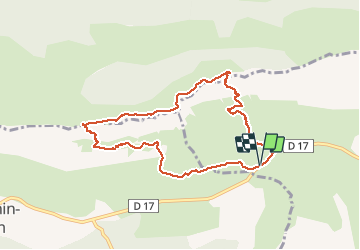

Length
9.9 km

Max alt
997 m

Uphill gradient
622 m
Km-Effort
18.2 km

Min alt
418 m

Downhill gradient
620 m
Boucle
Yes
Creation date :
2014-12-10 00:00:00.0
Updated on :
2014-12-10 00:00:00.0
5h47
Difficulty : Difficult

FREE GPS app for hiking
 SityTrail
IGN / Geographical institutes
SityTrail Plus
The world is yours!
About
Trail Walking of 9.9 km to be discovered at Provence-Alpes-Côte d'Azur, Bouches-du-Rhône, Puyloubier. This trail is proposed by ARPF.
Description
P3 T3 Jacques H 30/09/2014
Positioning
Country:
France
Region :
Provence-Alpes-Côte d'Azur
Department/Province :
Bouches-du-Rhône
Municipality :
Puyloubier
Location:
Unknown
Start:(Dec)
Start:(UTM)
712744 ; 4822496 (31T) N.
Comments