


les marmagnes Miramontr

Mascart
User

Length
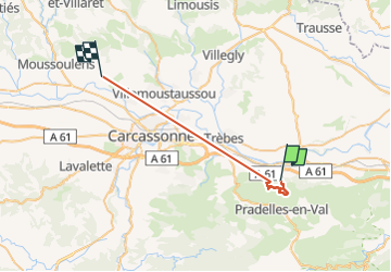
27 km

Max alt
504 m

Uphill gradient
661 m
Km-Effort
36 km

Min alt
87 m

Downhill gradient
716 m
Boucle
No
Creation date :
2022-12-13 06:19:47.149
Updated on :
2022-12-13 21:43:44.479
3h15
Difficulty : Medium

FREE GPS app for hiking
 SityTrail
IGN / Geographical institutes
SityTrail Plus
The world is yours!
About
Trail Walking of 27 km to be discovered at Occitania, Aude, Barbaira. This trail is proposed by Mascart.
Description
Bàrbaira boucle
Positioning
Country:
France
Region :
Occitania
Department/Province :
Aude
Municipality :
Barbaira
Location:
Unknown
Start:(Dec)
Start:(UTM)
460378 ; 4780053 (31T) N.
Comments