


2022-12-17_12h42m06__chantilly 6kmsl-2022gpxchantilly 6kmsl-2022

Marc ROUSSELOT
User
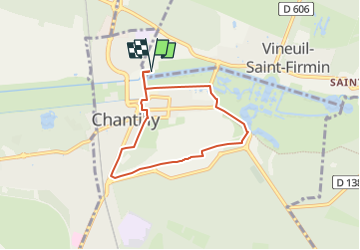

Length
5.6 km

Max alt
62 m

Uphill gradient
56 m
Km-Effort
6.3 km

Min alt
37 m

Downhill gradient
55 m
Boucle
Yes
Creation date :
2022-12-17 11:42:06.516
Updated on :
2022-12-17 11:42:09.202

FREE GPS app for hiking
 SityTrail
IGN / Geographical institutes
SityTrail Plus
The world is yours!
About
Trail of 5.6 km to be discovered at Hauts-de-France, Oise, Vineuil-Saint-Firmin. This trail is proposed by Marc ROUSSELOT.
Positioning
Country:
France
Region :
Hauts-de-France
Department/Province :
Oise
Municipality :
Vineuil-Saint-Firmin
Location:
Unknown
Start:(Dec)
Start:(UTM)
461250 ; 5449661 (31U) N.
Comments