


rocherousse

tyntyn
User
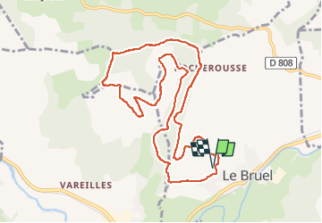

Length
11.3 km

Max alt
1003 m

Uphill gradient
420 m
Km-Effort
16.9 km

Min alt
711 m

Downhill gradient
421 m
Boucle
Yes
Creation date :
2022-12-12 12:30:23.684
Updated on :
2022-12-17 16:21:05.909
2h54
Difficulty : Difficult

FREE GPS app for hiking
 SityTrail
IGN / Geographical institutes
SityTrail Plus
The world is yours!
About
Trail Walking of 11.3 km to be discovered at Occitania, Lozère, Esclanèdes. This trail is proposed by tyntyn.
Positioning
Country:
France
Region :
Occitania
Department/Province :
Lozère
Municipality :
Esclanèdes
Location:
Unknown
Start:(Dec)
Start:(UTM)
527965 ; 4925578 (31T) N.
Comments