


Sainte Baume 8,5 km

rvapeldo
User GUIDE
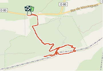


4h38
Difficulty : Medium

FREE GPS app for hiking
 SityTrail
IGN / Geographical institutes
SityTrail Plus
The world is yours!
About
Trail Walking of 8.4 km to be discovered at Provence-Alpes-Côte d'Azur, Var, Plan-d'Aups-Sainte-Baume. This trail is proposed by rvapeldo.
Description
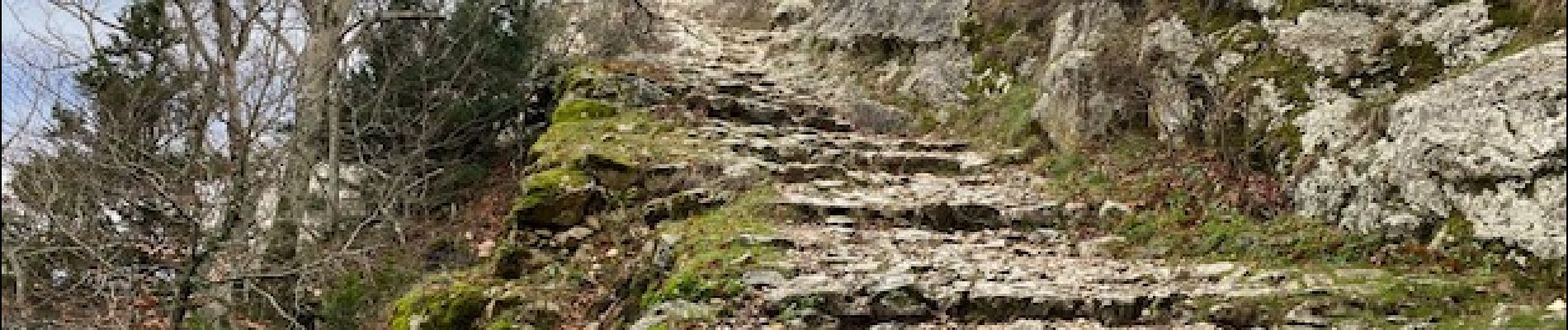
Parcours classique vers la grotte de Ste Baume et la chapelle St Pilon, toutes dédiées à Marie Madeleine. Le présent tracé comporte une tentative de gagner la crête et la chapelle par un sentier vers l’ouest, en bas de la grotte, mais le sol me paraissait trop glissant, car le sol était humide. Donc j’ai pris un parcours plus sage, par l’est, via le col St Pilon. Très joli parcours en bonne partie utilisé par des pélerinages depuis bien longtemps. Point de départ : un parking près de l’hotellerie pour les pèlerins de Ste Baume. Très joli parcours, j’y reviendrai volontiers plus parcourir la crête sur une plus grande longueur. La vue porte jusqu’à la mer.
Photos


Positioning
Comments
