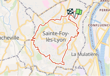
Sainte foy les lyon

daniellebou
User

Length
9.9 km

Max alt
319 m

Uphill gradient
250 m
Km-Effort
13.2 km

Min alt
214 m

Downhill gradient
252 m
Boucle
Yes
Creation date :
2022-12-24 00:07:29.187
Updated on :
2022-12-27 23:47:58.219
2h52
Difficulty : Difficult

FREE GPS app for hiking
 SityTrail
IGN / Geographical institutes
SityTrail Plus
The world is yours!
About
Trail Walking of 9.9 km to be discovered at Auvergne-Rhône-Alpes, Métropole de Lyon, Sainte-Foy-lès-Lyon. This trail is proposed by daniellebou.
Positioning
Country:
France
Region :
Auvergne-Rhône-Alpes
Department/Province :
Métropole de Lyon
Municipality :
Sainte-Foy-lès-Lyon
Location:
Unknown
Start:(Dec)
Start:(UTM)
640352 ; 5067108 (31T) N.
Comments