Trail Walking Paroy - paroy - Photo
© OpenStreetMap contributors
Length
Length
18.4 km
Max alt
Max alt
604 m
Uphill gradient
Uphill gradient
427 m
Km-Effort
Km-Effort  
24 km
Min alt
Min alt
250 m
Downhill gradient
Downhill gradient
429 m
Boucle
Boucle
Yes
Creation date :
2022-12-24 13:07:33.539
Updated on :
2022-12-26 20:00:06.0

(1 Reviews)

Walking
Walking
3h08
Difficulty : Medium

Scan this QR Code to open this trail in the SityTrail application

FREE GPS app for hiking

Logo SityTrail SityTrail

IGN / Geographical institutes

Download SityTrail from the App Store Download SityTrail from Google Play

Logo SityTrail SityTrail World

The world is yours!

Download SityTrail from the App Store Download SityTrail from Google Play Download SityTrail on Huawei AppGallery

About

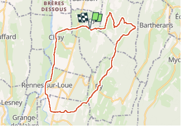
Trail Walking of 18.4 km to be discovered at Bourgogne-Franche-Comté, Doubs, Paroy. This trail is proposed by eltonnermou.

Description

parking terrain de foot rue marronniers
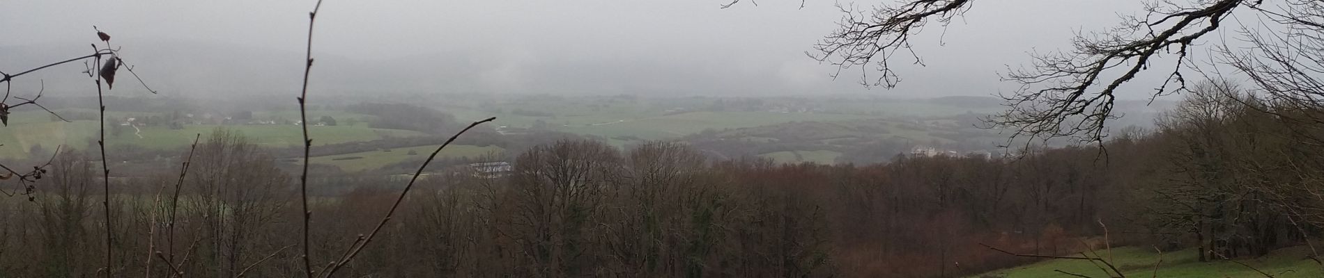
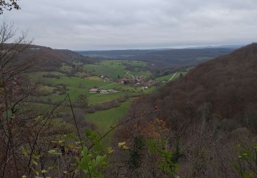
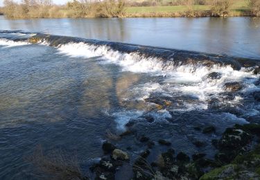
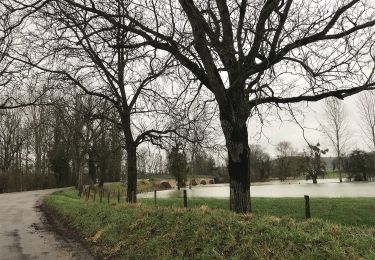
Belle randonnée avec de beaux points de vue (faites le détour au belvédère de Ronchaux) sur la vallée de la Loue. Dans le sens de la marche vous trouverez des tables à 8,6km pour votre pic-nique.
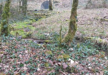
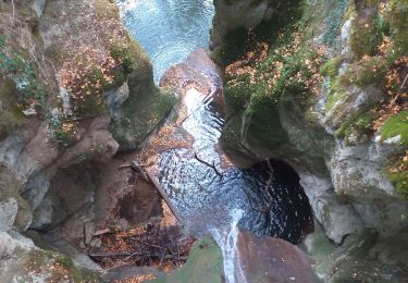
Dans ces espaces escarpés laissez vous surprendre par la faune sauvage (chamois, chevreuil, ...). Petit bémol, beaucoup trop de goudron  (et pas assez de plumes) à mon goût.
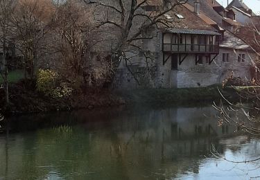
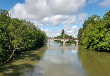
Attention par crue de la Loue, le cheminement entre Rennes et Chay peut être rendu impossible !!!

Elevation profile

Photos

22 photos in total. Please click on a photo to see them all in the gallery.

Positioning

Country:
France
Region :
Bourgogne-Franche-Comté
Department/Province :
Doubs
Municipality :
Paroy
Location:
Unknown
Start:(UTM)
719024 ; 5213603 (31T) N.

Comments

Please log in to post a review or rate the element


Trails nearby

Trail Walking Échay - echay et ses belvédères - Photo
Walking
eltonnermou

Walking

Medium
(1)
Échay, Bourgogne-Franche-Comté, Doubs, France
12.8 km | 17.5 km-effort
2h 5min
Yes
Trail Walking Myon - myon les lunettes à Stéphane  - Photo
Walking
eltonnermou

Walking

Medium
Myon, Bourgogne-Franche-Comté, Doubs, France
17.4 km | 23 km-effort
5h 2min
Yes
Trail Walking Rennes-sur-Loue - Rennes sur Loue - Photo
Walking
eltonnermou

Walking

Medium
Rennes-sur-Loue, Bourgogne-Franche-Comté, Doubs, France
21 km | 27 km-effort
4h 7min
Yes
Trail Walking Myon - Myon le gour de conche - Photo
Walking
eltonnermou

Walking

Easy
Myon, Bourgogne-Franche-Comté, Doubs, France
14.4 km | 20 km-effort
4h 57min
Yes
Trail Walking Myon - Myon 3 collines - Photo
Walking
eltonnermou

Walking

Easy
Myon, Bourgogne-Franche-Comté, Doubs, France
16.5 km | 23 km-effort
5h 42min
Yes
Trail Walking Myon - Myon - Photo
Walking
eltonnermou

Walking

Easy
Myon, Bourgogne-Franche-Comté, Doubs, France
14.7 km | 19.5 km-effort
8h 32min
Yes
Trail On foot Port-Lesney - Chemin des Gabelous - Photo
On foot
PRO

On foot

Easy
Port-Lesney, Bourgogne-Franche-Comté, Jura, France
5.9 km | 6.6 km-effort
1h 30min
No
Trail Walking Port-Lesney - Vaulgrenan depuis Port Lesney. - Photo
Walking
dcharbonnier

Walking

Easy
(1)
Port-Lesney, Bourgogne-Franche-Comté, Jura, France
14.7 km | 18.8 km-effort
3h 57min
Yes
Trail Bicycle tourism Liesle - Liesle - Pont-de-Poitte - Photo
Bicycle tourism
karawatsj

Bicycle tourism

Difficult
Liesle, Bourgogne-Franche-Comté, Doubs, France
77 km | 90 km-effort
4h 59min
No


Close
My subscriptions