


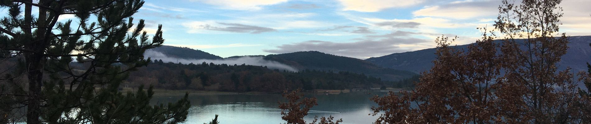
Plan d’eau de St Genis

Pierrannick
User
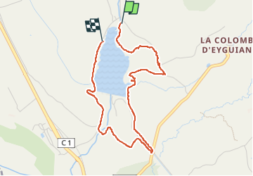

Length
4.2 km

Max alt
671 m

Uphill gradient
73 m
Km-Effort
5.2 km

Min alt
613 m

Downhill gradient
68 m
Boucle
No
Creation date :
2022-12-21 13:36:08.0
Updated on :
2022-12-26 09:14:06.508
1h37
Difficulty : Easy

FREE GPS app for hiking
 SityTrail
IGN / Geographical institutes
SityTrail Plus
The world is yours!
About
Trail Walking of 4.2 km to be discovered at Provence-Alpes-Côte d'Azur, Hautes-Alpes, Garde-Colombe. This trail is proposed by Pierrannick.
Description
Petite balade
Photos

Positioning
Country:
France
Region :
Provence-Alpes-Côte d'Azur
Department/Province :
Hautes-Alpes
Municipality :
Garde-Colombe
Location:
Unknown
Start:(Dec)
Start:(UTM)
720636 ; 4916638 (31T) N.
Comments