


y10_tenner_chruez

My Switzerland
Optez pour le retour à la nature GUIDE+

Length
9.3 km

Max alt
2007 m

Uphill gradient
371 m
Km-Effort
16.4 km

Min alt
986 m

Downhill gradient
1032 m
Boucle
No
Creation date :
2014-12-10 00:00:00.0
Updated on :
2014-12-10 00:00:00.0
3h26
Difficulty : Unknown

FREE GPS app for hiking
 SityTrail
IGN / Geographical institutes
SityTrail Plus
The world is yours!
About
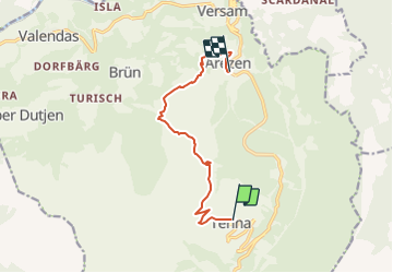
Trail Other activity of 9.3 km to be discovered at Grisons, Surselva, Safiental. This trail is proposed by My Switzerland.


Positioning
Country:
Switzerland
Region :
Grisons
Department/Province :
Surselva
Municipality :
Safiental
Location:
Unknown
Start:(Dec)
Start:(UTM)
525932 ; 5177177 (32T) N.
Comments