


y10_veia_traversina

My Switzerland
Optez pour le retour à la nature GUIDE+

Length
12 km

Max alt
1059 m

Uphill gradient
864 m
Km-Effort
23 km

Min alt
673 m

Downhill gradient
610 m
Boucle
No
Creation date :
2014-12-10 00:00:00.0
Updated on :
2014-12-10 00:00:00.0
5h55
Difficulty : Unknown

FREE GPS app for hiking
 SityTrail
IGN / Geographical institutes
SityTrail Plus
The world is yours!
About
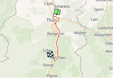
Trail Other activity of 12 km to be discovered at Grisons, Viamala, Thusis. This trail is proposed by My Switzerland.


Positioning
Country:
Switzerland
Region :
Grisons
Department/Province :
Viamala
Municipality :
Thusis
Location:
Unknown
Start:(Dec)
Start:(UTM)
533664 ; 5171783 (32T) N.
Comments