


Aire des Mascas-pas de Marseille-Lubéron

Berpav
User

Length
15.3 km

Max alt
1058 m

Uphill gradient
470 m
Km-Effort
22 km

Min alt
685 m

Downhill gradient
471 m
Boucle
Yes
Creation date :
2022-12-29 13:33:57.882
Updated on :
2022-12-29 13:35:34.679
4h53
Difficulty : Very difficult

FREE GPS app for hiking
 SityTrail
IGN / Geographical institutes
SityTrail Plus
The world is yours!
About
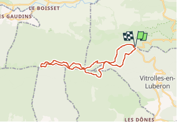
Trail Walking of 15.3 km to be discovered at Provence-Alpes-Côte d'Azur, Vaucluse, Vitrolles-en-Luberon. This trail is proposed by Berpav.
Description
A la journée
Positioning
Country:
France
Region :
Provence-Alpes-Côte d'Azur
Department/Province :
Vaucluse
Municipality :
Vitrolles-en-Luberon
Location:
Unknown
Start:(Dec)
Start:(UTM)
707451 ; 4856118 (31T) N.
Comments