


Larthousette +515

claude nier
User

Length
10.7 km

Max alt
1674 m

Uphill gradient
515 m
Km-Effort
17.5 km

Min alt
1196 m

Downhill gradient
521 m
Boucle
Yes
Creation date :
2022-12-29 16:20:59.157
Updated on :
2022-12-29 16:22:38.791
3h59
Difficulty : Difficult

FREE GPS app for hiking
 SityTrail
IGN / Geographical institutes
SityTrail Plus
The world is yours!
About
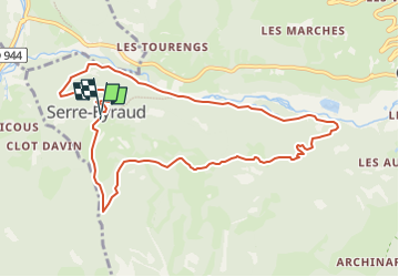
Trail Walking of 10.7 km to be discovered at Provence-Alpes-Côte d'Azur, Hautes-Alpes, Orcières. This trail is proposed by claude nier.
Description
Petite rando sympatique
a faire ....
Positioning
Country:
France
Region :
Provence-Alpes-Côte d'Azur
Department/Province :
Hautes-Alpes
Municipality :
Orcières
Location:
Unknown
Start:(Dec)
Start:(UTM)
284103 ; 4950817 (32T) N.
Comments